Capabilities
On this page 5
Eighteen capabilities in three groups. A capability is a job the platform does: what it flies, how often, what it hands back, and what the dashboard can measure about it afterwards.
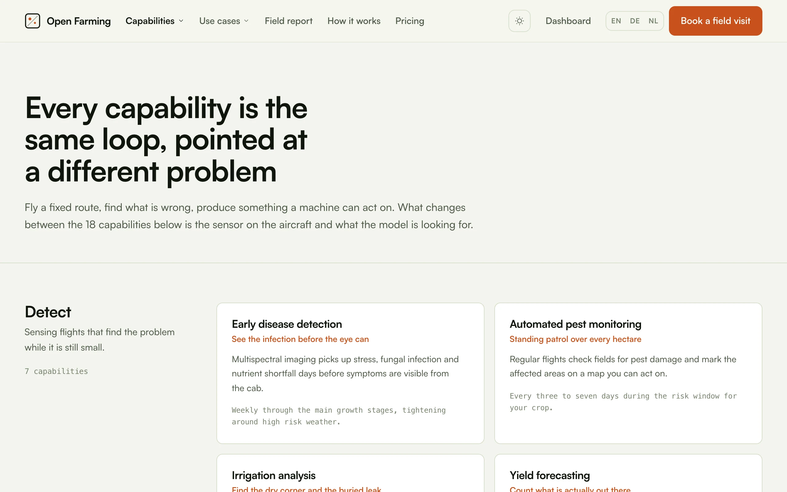
The same catalog these pages document, as the site renders it at openfarm.ing/features.
Every page follows the same shape, ending with Build it: the parts list with EU and US sources, and the in-house software that replaces the per-hectare licence. The build guide covers the parts that are common to all of them.
Detect
Sensing flights that find the problem while it is still small.
| Capability | Does | Normal cadence |
|---|---|---|
| Early disease detection | Multispectral imaging picks up stress and infection days before it is visible from the cab | Weekly through the main growth stages |
| Automated pest monitoring | Regular flights check for pest damage and mark the affected areas | Every three to seven days in the risk window |
| Irrigation analysis | Thermal imaging exposes dry patches, leaks and uneven coverage | Fortnightly through the irrigation season |
| Yield forecasting | Counts plants, fruit or ears and turns counts into a per-zone estimate | Establishment, then two or three times through fill |
| Automated field mapping | One flight produces elevation, drainage, headlands and problem ground | Once per field, refreshed after drainage work |
| Wildlife detection before mowing | Thermal search for fawns, hares and ground nesting birds ahead of the mower | Every first cut |
| Soil compaction detection | Growth patterns over recorded machine traffic show where the soil has closed up | Once or twice per season, at peak biomass |
Act
Treatment that follows the map, so only the affected ground is touched.
| Capability | Does | Normal cadence |
|---|---|---|
| Targeted weed control | Finds weeds plant by plant, treats only the affected square metres | Two to four scouting flights per crop |
| Precision fertilisation | Works out which parts are under-supplied and builds a variable rate map | Before each split application |
| Drone seeding | Broadcasts seed onto ground too steep, wet or awkward for a machine | On demand |
| Frost protection | Measures temperature across a block and names tonight's cold pockets | Every clear night in the risk window |
| Pollination support | Assists pollination indoors and where pollinator activity is short | Daily through flowering |
| Autonomous bird deterrence | Clears birds on demand instead of a permanent noise source | Triggered by detection, not a timer |
| Automated livestock herding | Walks a mob between grazing blocks on a route you approved | Whenever the rotation is due |
Operate
The service, the fleet and the reporting that keep it running.
| Capability | Does | Normal cadence |
|---|---|---|
| Flights as a service | You book a schedule, we own the drones, the pilots and the paperwork | Set once per crop |
| Autonomous drone network | Drones launch from docks on their own schedule and dock again | Daily, weather permitting |
| Livestock and fence checks | Walks the fence line, counts the herd, flags animals that need a decision | Daily or twice daily in the grazing season |
| Sustainability reporting | Flight, weather, soil and machine records become the figures buyers ask for | Continuous |
| Field decision assistant | Reads every layer and answers in plain language: what, where, by when | After every flight |
What flies what
Payloads, not aircraft. One airframe carries several of these; the payload is what changes.
| Payload | Capabilities |
|---|---|
| High resolution RGB | Weed control, field mapping, yield forecasting, pest monitoring, compaction, bird deterrence |
| Five band multispectral | Disease, fertilisation, pest monitoring, compaction, yield forecasting |
| Radiometric thermal | Irrigation, wildlife, frost, livestock |
| LiDAR | Field mapping on wooded or tall canopy blocks, canopy height for weed control |
| Hopper | Seeding |
| Airflow | Pollination |
| None | Sustainability reporting and the field assistant, which consume other capabilities' output |
Two capabilities declare no payload of their own. That is deliberate and worth preserving: they reason over the record rather than adding a flight.
Which one to start with
If you are building this rather than buying it, the order that gets a working system fastest is:
- Automated field mapping. It is the base layer everything else sits on, the payload is one ordinary camera, and the whole pipeline is open source. Nothing else works properly without it.
- Wildlife detection before mowing. The cheapest payload, the clearest legal footing, an obvious buyer, and the flight is short.
- Targeted weed control. The one with the money in it, and the one that needs a real model and a real prescription exporter. Do it third, not first.